Fisher Towers Trail: Worth the Drive from Moab?
The Fisher Towers trail delivers on views while being a less-crowded route.
Hike from slot canyons to plateau tops on the Fisher Towers trail. It’s a 4.6-mile out-and-back trail that allows dogs. You’ll find towering red rock spires, panoramic desert views, and a short ladder with an optional bypass.
If you’re looking for a rewarding hike outside Canyonlands and Arches National Parks, Fisher Towers is absolutely worth the drive. Highway 128 doesn’t lack for scenic vistas, either.
➡️ Find more off-the-beaten-path hikes in my Utah Adventure Guide.
Disclosure: This post may contain affiliate links. If you purchase through these links, I may earn a small commission at no extra cost to you. I only recommend products I’ve personally used, tested, and genuinely love. Thank you for supporting Emma Gets Outside!
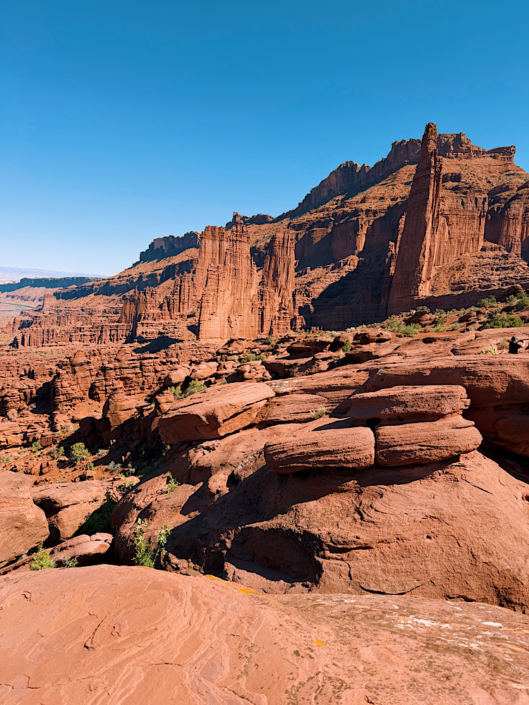
Is Fisher Towers Trail Worth It?
Yes! If you’re looking for a less-crowded trail and don’t mind driving a bit outside of town, the Fisher Towers trail is a real winner. Not to mention the drive to get there is scenic in itself, you can make a quick stop in Castle Valley and admire the Colorado River for miles.
Look at my complete Southern Utah guide map on Rexby to learn more about scenic stops like Castle Valley.
Fisher Towers Trail at a Glance
- Location: Near Moab, Utah
- Distance: 4.6 mi
- Elevation Gain: 1,200 ft
- Difficulty: Moderate
- Trail Type: Out & Back
- Dogs Allowed: Yes (leash required)
- Park Pass Required: No
- Time Needed: 2-4 hours
- Best Time: Early morning
Fisher Towers Trail Map
Planning a bigger Southern Utah trip? I’ve pinned over 100 hikes, viewpoints, campgrounds, and hidden gems in my interactive Southern Utah Rexby guide.
Why Hike Fisher Towers Trail?
Get up close and personal with massive red rock monoliths. Hike up the cliffside to an incredible overlook of the Onion Creek road. There are views the entire way up this trail, and I always have fun pointing out new things each time I hike. I consider it one of the best hikes in Moab.
Even more reasons to hike the Fisher Towers trail:
- Dog-friendly
- Incredible red rock towers
- No national park crowds
- No entrance fee
- Scenic drive
- Rewarding overlook
- Morning shade
Getting to the Trailhead
The Fisher Towers trail is about 45 minutes outside of Moab, but don’t let that deter you from experiencing this rewarding trail. Scenic Highway 128 is one of my favorite stretches of highway in Utah. It’s well-maintained and fun to drive.
Parking at Fisher Towers can be tight. There is an overflow lot below the main lot, as well as a vault toilet for trail users. You’ll see the few campsites just beyond the pit toilet.
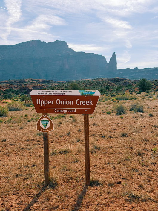
Camping Near Fisher Towers Trail
If you want to camp in this area, I’d recommend the Upper Onion Creek campground. You get views of Fisher Towers AND a glimpse of Castleton over in Castle Valley.
This is a popular campground, and sites fill fast. Try to get there around midday to find a spot.
Make It a Weekend Adventure
Take your time and explore this area. We hiked Fisher Towers in the morning, went to the Upper Onion Creek campground and paid for our spot to secure it, and then hiked the Grandstaff Canyon Trail in the afternoon.
Make a stop at Castle Valley around sunset to watch the towers glow orange. Back at camp, we enjoyed playing cards in the blue hour light.
The next day, we hiked Mary Jane Slot Canyon, just a 12-minute drive from the Upper Onion Creek campground. Dogs are also allowed on this trail, and it’s quite refreshing to walk in the creek. There’s a special surprise if you make it to the end of the hike.
What the Fisher Towers Trail Is Actually Like
From the parking lot, you actually descend down first. Peer into small slot canyons and marvel at the height of the towers from down here. Then start the climb up to right below the towers.
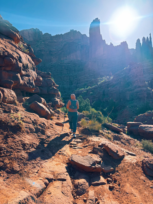
You’ll be able to see the trail winding along the cliffside from across the canyon. The sun is behind the towers in the morning, creating a cool backlit effect.
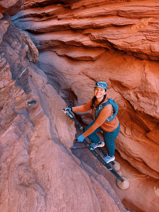
The Ladder (Don’t Let It Scare You)
There is a short ladder with some scrambling in the middle of the trail. If you are hiking with your dog or don’t feel comfortable on a ladder, there is a bypass trail.
The “trail” isn’t marked and requires some scrambling to get farther into the canyon above the ladder section. My friends (who are experienced hikers) were able to navigate the bypass with their large dog that couldn’t be carried down the ladder.
You must still be comfortable with off-route scrambling to take the bypass, so the ladder is still the way I recommend completing the trail. The ladder is very sturdy and isn’t very high.
Final Climb to the Fisher Towers Viewpoint
The viewpoint is off on a peninsula. We actually got a little turned around right at the peninsula intersection. There was a faint trail that led off to the left that we followed, but you must stick to the right side of the peninsula.
We checked our AllTrails map and eventually found where we had missed the main trail. The desert is definitely one of those places where it’s easy to get lost. Especially when hiking trails follow sandstone slabs with no footprints. Download a map before you arrive at the trailhead.
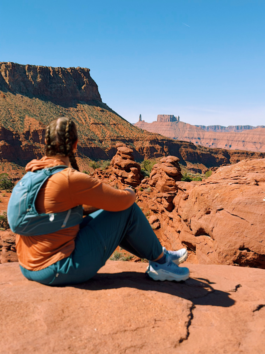
Views from the Fisher Towers Overlook
The view from the top of the Fisher Towers trail is well worth the effort. You can take in the tower formations and look for tiny climbers on the spires. The Colorado River and the continuing canyon are visible beyond.
Hike all the way to the end of the peninsula and cast your eyes down to Onion Creek. You might spot some cars driving on the road.
Finally, also find the famous buttes and pinnacles of Castle Valley on the horizon. There is so much to gaze upon in every direction that I found myself not wanting to leave.
How Difficult Is Fisher Towers Trail?
I would consider the Fisher Towers trail to be a true moderate trail. AllTrails says the elevation gain is 1,500 feet, but I only tracked 1,200, and some people say it’s as little as 800 feet.
Besides the ladder section, there really isn’t any scrambling. There are some narrow sections with steep drop-offs, but they are short-lived. If you are afraid of heights, this might not be the best trail for you.
I would not attempt this trail in the middle of a summer day. Later in the morning, the shade disappears, and it can get very hot in the blazing sun. If you start early when the temperatures are still cool and the sun hasn’t yet hit a majority of the trail, you’ll be alright.
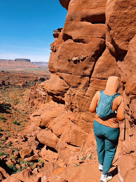
Narrowest section of trail
Fisher Towers is best for:
- Travelers looking to escape the crowds around Moab
- Hikers who enjoy big scenic views
- Visitors traveling with dogs
- Photographers
- Families with older children who are comfortable with heights
It may not be for you if:
- You dislike exposure
- You’re hiking during a hot summer afternoon
- You’re looking for lots of shade
- You’re uncomfortable on narrow trails
Try the nearby Mary Jane Slot Canyon (Professor Creek) or Grandstaff Canyon trail if you don’t like the sound of the Fisher Towers trail.
Hiking with Dogs on Fisher Towers Trail
Dogs must be on a leash while hiking at Fisher Towers. Bring plenty of water for your furry friend and monitor how they handle the heat on a warm day.
Small dogs can be carried up and down the ladder section, but larger dogs will have to take the bypass. There is some scrambling involved either way you go.
Best Time to Hike Fisher Towers Trail
You can hike the Fisher Towers trail all year. I’ve hiked it in late fall and mid-spring. The advantage of hiking in the fall and winter is that the warm sun is welcome, helping combat the chill.
I wouldn’t hike this trail if it were snowy or muddy, as some of the narrow sections could become slippery.
What to Bring
- Water
- Electrolytes
- Trail runners
- Sun protection
- Trekking poles
- Dog bowl
- Snacks
- Camera
Use my day hike packing list as a guide to help you prepare for most hikes.
Things to Know Before You Go
- No entrance fee is required.
- Dogs are welcome but must remain leashed.
- The ladder has a bypass, although it requires some off-route scrambling.
- Morning offers the coolest temperatures and the most shade.
- Download an offline map before arriving.
Fisher Towers is one of the most rewarding hikes near Moab if you’re willing to venture beyond the national parks. Between the dramatic sandstone towers, the scenic Highway 128 drive, and the panoramic overlook, it’s a trail I happily recommend (and one I’d hike again).
📌 Pin this image on Pinterest to save this post for reference.
FAQs About the Fisher Towers Trail
Is Fisher Towers Trail dog friendly?
Yes. Dogs are allowed on a leash. However, the trail includes a short ladder. While there is a bypass, it requires off-route scrambling, so owners of larger dogs should consider whether their dog can safely navigate that section.
How long does it take to hike Fisher Towers?
Most hikers finish the trail in 2-4 hours, depending on how long they spend enjoying the viewpoints or taking photos.
How long is Fisher Towers Trail?
The trail is approximately 4.6 miles out and back with about 1,200 feet of elevation gain, although some hiking apps report slightly different elevation totals.
When is the best time to hike Fisher Towers?
Spring and fall are ideal. During warmer months, start early in the morning while much of the trail is still shaded.
How difficult is Fisher Towers Trail?
Fisher Towers Trail is a moderate hike with steady climbing, some narrow sections, and one short ladder. Most hikers with some trail experience should have no trouble completing it, but anyone uncomfortable with heights may find parts of the trail challenging.
Do you need a park pass?
No. Fisher Towers Trail is located on BLM land, so no entrance fee or national park pass is required.