10 Hikes in Yosemite Worth Your Time
Looking for recommendations on hikes in Yosemite from someone who’s actually hiked the trails?
I spent a week exploring Yosemite National Park and hiking Yosemite Valley, the high country, and the southern part of the park. I hiked everything from Nevada Falls and Cathedral Lakes to North Dome, May Lake, and Mariposa Grove.
I’m not going to list every hike in Yosemite. In fact, I don’t cover the famous hike to Half Dome because I didn’t get a permit and thus didn’t get to hike it myself. I’m only detailing trails where I have first-hand experience.
The goal is to help you decide which hikes to prioritize. My recommendations consider scenery, difficulty, crowds, variety, and overall experience.
➡️ Find more U.S. National Park content in my comprehensive travel guide. From California and Colorado to Utah and Nevada.
Disclosure: This post may contain affiliate links. If you purchase through these links, I may earn a small commission at no extra cost to you. I only recommend products I’ve personally used, tested, and genuinely love. Thank you for supporting Emma Gets Outside!
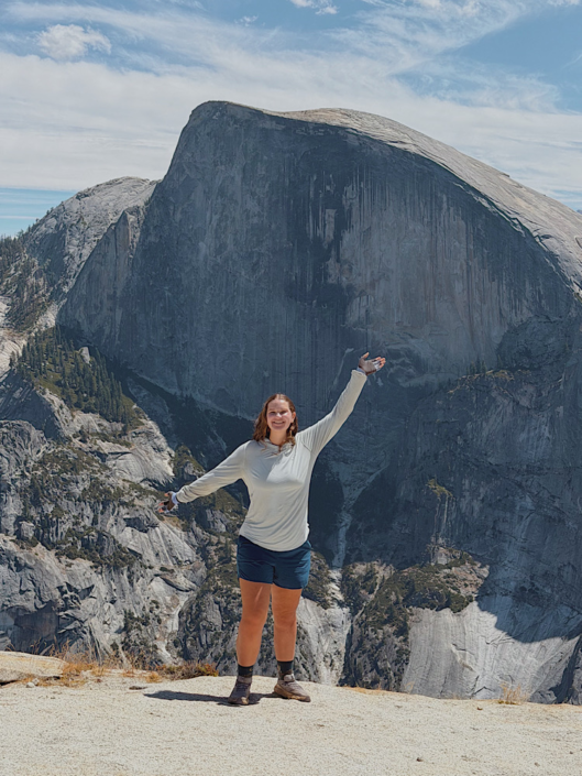
My Quick Picks: Best Hikes in Yosemite
- Best overall: Vernal & Nevada Falls
- Best short hike with big views: Sentinel Dome
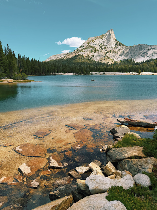
- Best alpine lake: Lower Cathedral Lake
- Best giant sequoias: Mariposa Grove
- Best easy hike: May Lake
- Best quieter hike: North Dome and Indian Rock
If you only have time for three hikes, I’d choose these…
- Cathedral Lakes for alpine scenery and a true high-country Yosemite experience
- Vernal & Nevada Falls for waterfalls, granite scenery, and a more classic Yosemite hike
- North Dome and Indian Rock for huge views with fewer people than many of Yosemite’s most famous trails
All three are relatively long hikes, so they aren’t the best choices for every itinerary. If you want shorter hikes that still deliver spectacular scenery, swap in May Lake and Sentinel Dome.
➡️ Find even more things to do in Yosemite besides hiking in my experience-based guide.
Before You Choose a Hike in Yosemite
Know these things:
More Than Yosemite Valley
I didn’t know that Yosemite National Park was so big until I started researching for my own trip. Yosemite Valley was all I had heard about before.
We spent 7 days in Yosemite without leaving the park boundaries. Driving around 300 miles, we had to fill up our tank twice at gas stations in the park. Some of my favorite hikes were outside Yosemite Valley, so I strongly recommend looking beyond the Valley when choosing your hikes.
Consider Elevation
A short high-country hike can feel very different from a Valley hike because of the elevation, terrain, and exposure. If you’re coming from near sea level, the elevation can make a hike feel harder than the mileage suggests.
Where Are You Staying?
We camped all over the park. Location matters enormously when planning Yosemite hikes. You don’t want to be driving an hour each way to a trailhead because you’re staying in the Valley. When building your itinerary, look at where your hikes are located and consider staying in different areas of the park if it makes sense for your trip.
Check Trail and Road Conditions
I wanted to hike to the top of Yosemite Falls, but found out it wasn’t flowing in mid-August when we were there. The hike would still have the same impressive views, but I wanted to hike it when the falls are flowing.
Some roads might also be closed seasonally. For higher-elevation trails, snow can be a factor. Check the current conditions in Yosemite on the National Park Service website.
The Best Hikes in Yosemite
These aren’t ranked in any particular order. I thoroughly enjoyed a mix of longer and shorter trails all around Yosemite. This guide is meant to help you make decisions on which hikes to tackle during your visit to Yosemite.
1. Cathedral Lakes
Best For: Alpine scenery
Trail Map: Cathedral Lakes via Medlicott Dome
Trail Stats
- Distance: 2.8 mi
- Elevation Gain: 840 ft
- Difficulty: Moderate
- Area: Tioga Road
The stats above are for the Lower Cathedral Lake via the Medlicott Dome approach. I continued to Upper Cathedral Lake and walked around the Lower Lake, bringing my total to 7.1 miles and 1,480 feet of elevation gain.
My Trail Experience
The standard trail to Cathedral Lakes was longer than we had time for, so my husband and I took the shorter climber’s approach. We saw only one group the entire way to the Lower Lake.
The sharp Cathedral Peak is an iconic landmark, situated perfectly behind the lake from the Medlicott Dome approach. We hiked further to the Upper Cathedral Lake, but honestly, I felt the Lower Lake was far more impressive. Walk around the Lower Lake in its entirety to get the best views.
Emma’s Verdict
One of my favorite hikes of the trip, and one I’d prioritize if you have a full day for the high country. The combination of alpine scenery, Cathedral Peak, and relatively few people made this one stand out for me. If you’re already driving to Tuolumne Meadows, I think it’s worth the time.
➡️ Read my full Cathedral Lakes Yosemite hiking guide for the route, parking details, and what I’d do differently.
2. North Dome and Indian Rock
Best For: Panoramic Yosemite views
Trail Map: North Dome via Tioga Road
Trail Stats
- Distance: 9.7 mi
- Elevation Gain: 2,070 ft
- Difficulty: Hard
- Area: Tioga Road
My Trail Experience
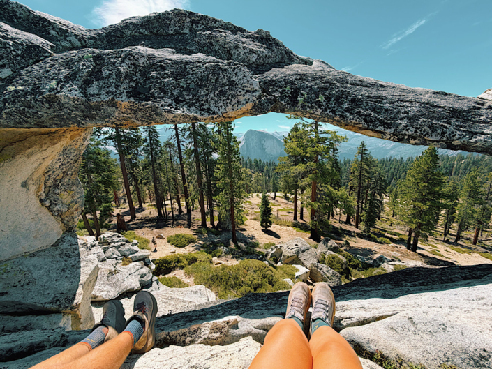
Don’t skip the turnoff to Indian Rock. It is well worth the short distance off the main trail. The arch perfectly frames Half Dome and is the only arch in Yosemite National Park.
Once you can see North Dome, it can be tempting to quit and turn around, but I assure you the scenery from the Dome is a much better vantage point than from above. You get so close to Half Dome that I could see tiny dots of people on top.
Emma’s Verdict
Since the trail mostly descends first, you need to conserve your energy for the climb out. Looking over the edge of North Dome to the Valley below was one of the best views in the park. We had the whole Dome to ourselves for the 30-or-so minutes we stopped and soaked it all in.
➡️ Read my in-depth guide to hiking North Dome in Yosemite.
3. Vernal and Nevada Falls via the Mist Trail
Best For: Waterfalls
Trail Map: Nevada Falls via Mist Trail
Trail Stats
- Distance: 5.9 mi
- Elevation Gain: 2,125 ft
- Difficulty: Hard
- Area: Yosemite Valley
When I hiked this, the lower section of the Mist Trail to Vernal Falls was closed. My husband and I had to take the John Muir Trail (JMT) up to Clark Point, then descend toward the top of Vernal Falls before continuing on the Mist Trail to the top of Nevada Falls. From there, we took the suggested route of descending the JMT back to the trailhead.
The listed stats are for the standard route. Because of the closure, our actual route was 8.3 miles with 2,800 feet of elevation gain.
My Trail Experience
I was disappointed the lower Mist Trail was closed up to Vernal Falls. But there’s a viewpoint between Clark Point and the top of Vernal Falls that I wouldn’t have seen if the trail hadn’t been closed.
If you want to make this trail a loop, which I highly recommend, start with the Mist Trail and descend the JMT. The Mist Trail up to Nevada Falls was steep, so I’d rather climb it than descend it. Descending the JMT is a bit easier on the knees.
Emma’s Verdict
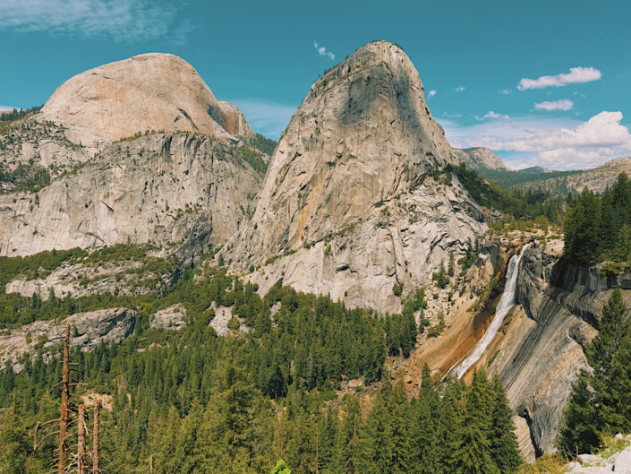
I thought the views of Nevada Falls with the Liberty Cap Dome beside it were the best from the JMT. Standing at the top of both Vernal and Nevada Falls was a unique experience. Instead of simply viewing the waterfalls from below, you get to stand right at the top of them.
If you’re only going to do one hike in Yosemite Valley, make it this one.
➡️ Full trail guide to Vernal and Nevada Falls hike.
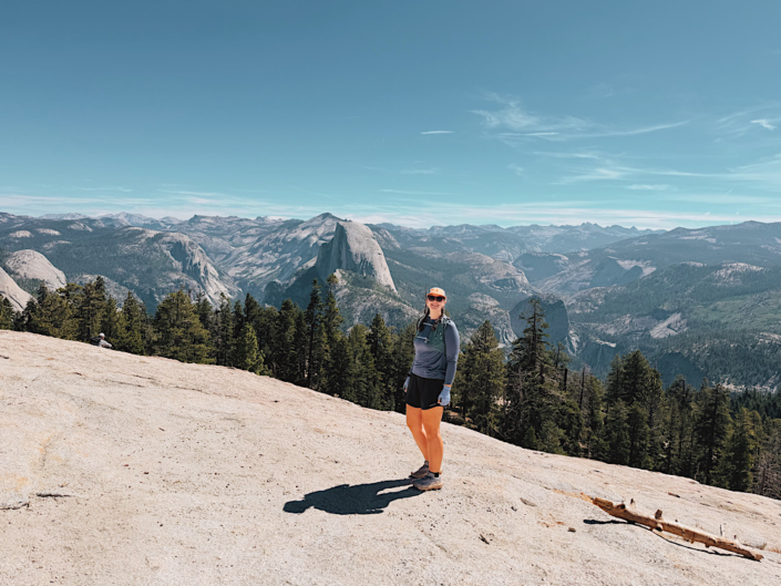
4. Sentinel Dome and Taft Point
Best For: Big views with Half Dome
Trail Map: Sentinel Dome and Taft Point Loop
Trail Stats
- Distance: 5.2 mi
- Elevation Gain: 1,100 ft
- Difficulty: Moderate
- Area: Glacier Point Road
My Trail Experience
I made this a loop, even though you can hike both as an out-and-back if you prefer. Starting with the Sentinel Dome and continuing over to Taft Point saves you from doing an 800-foot climb in a single go.
Sentinel Dome offered more impressive views in my opinion, but Taft Point featured dizzying cliff drop-offs.
Emma’s Verdict
Making a loop was a quieter trail experience. Most people do out-and-back style to each point. Even though the loop adds a mile compared to hiking directly to each viewpoint and back, the trail was shaded and peaceful, and I’d recommend hiking it this way.
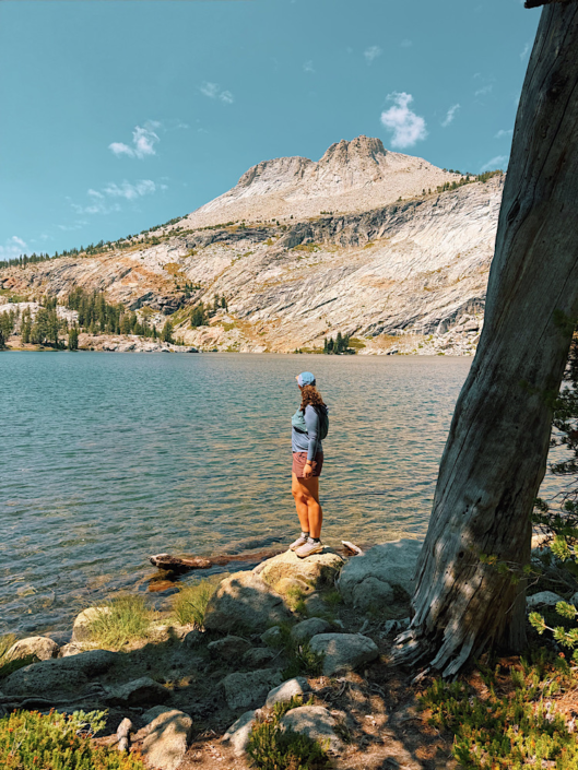
5. May Lake
Best For: Short hike to an alpine lake
Trail Map: May Lake
Trail Stats
- Distance: 2.4 mi
- Elevation Gain: 490 ft
- Difficulty: Moderate
- Area: Tioga Road
My Trail Experience
I didn’t know that this was a popular backpacking trail. You can stay at the May Lake High Sierra Camp in a fully set-up camp (permits required). Many people hiked the one mile with big bags.
My husband and I hiked up in 25 minutes and spent time admiring the lake. We saw the people we passed coming up on the way down. They asked disbelievingly if we had already been to the lake. Compared to many of the hikes on this list, this one felt very easy.
Emma’s Verdict
May Lake is gorgeous, and the short trail makes it more accessible to those who don’t want a long, strenuous hike. The parking lot filled up fast on a Saturday morning. Consider hiking this on a weekday or arriving early.
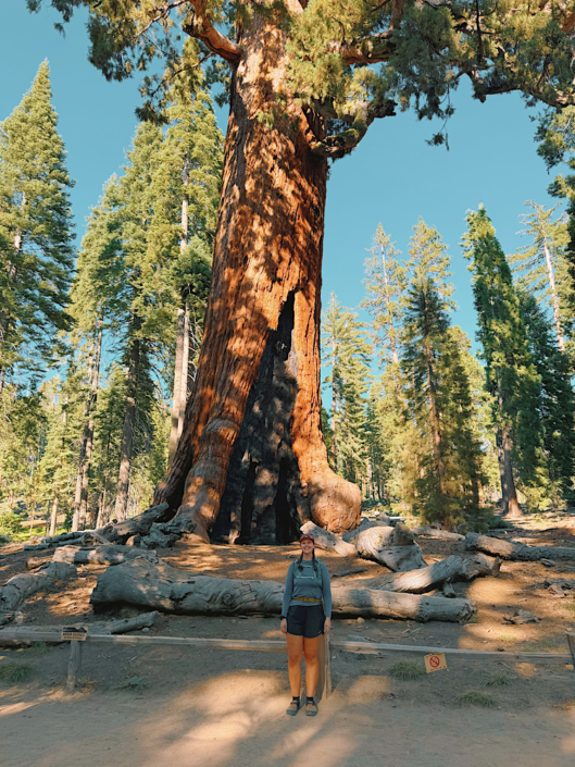
6. Mariposa Grove and the Grizzly Giant
Best For: Giant sequoias
Trail Map: Grizzly Giant Loop
Trail Stats
- Distance: 2.1 mi
- Elevation Gain: 400 ft
- Difficulty: Easy
- Area: Wawona
My Trail Experience
You’ll need to park and take a shuttle into the main hiking area when it’s operating. Check the National Park Service website for more details about the Mariposa Grove shuttle. When the shuttle isn’t operating, you can walk from the parking area into the grove.
This was my first time seeing giant sequoias. We did the Grizzly Giant Loop Trail, but if you have more time, you can hike for miles around Mariposa Grove. The initial hike up to the Grizzly Giant felt crowded because we all got off the shuttle at the same time, but on the backside of the loop, virtually no one was there.
Emma’s Verdict
I’d spend more time here if your itinerary allows. The Grizzly Giant was indeed remarkable. Hike the loop rather than returning the same way you came with everyone else.
➡️ Read my full Mariposa Grove Grizzly Giant trail guide for more details on the experience.
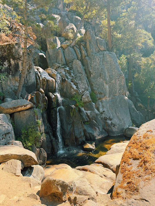
7. Chilnualna Falls
Best For: A less-crowded waterfall experience
Trail Map: Chilnualna Falls
Trail Stats
- Distance: 8 mi
- Elevation Gain: 2,225 ft
- Difficulty: Moderate
- Area: Wawona
I only hiked the lower portion of Chilnualna Falls, so I’m not going to pretend this is a review of the entire route. Hiking to just the lower falls is 0.75 miles round trip.
My Trail Experience
The trail was buggy, and it was a hot day. I really wanted to hike to the top waterfall, but the conditions weren’t great. Portions of this trail are very exposed to the sun, making a warm day feel even warmer. The bugs swarming my face didn’t help either.
The lower falls are worth it if you’re looking for something quick and not crowded. We didn’t see anyone else. It’s odd; you drive through a residential area to get to the trailhead.
Emma’s Verdict
Pick a day that’s warm but not unbearably hot so you can hike and enjoy the water. This is a trail I will certainly be returning to complete.
8. Tuolumne Grove
Best For: A quieter giant sequoia experience
Trail Map: Tuolumne Grove
Trail Stats
- Distance: 2.7 mi
- Elevation Gain: 610 ft
- Difficulty: Moderate
- Area: Tioga Road
My Trail Experience
If you don’t want to deal with the Mariposa Grove shuttle and want a less-busy giant sequoia experience, hike the Tuolumne Grove. The hike starts all downhill, so keep in mind that you’ll be hiking uphill on the way back.
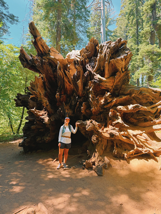
The Tuolumne Grove features a massive downed hollow sequoia. You can look through the trunk, and that was definitely the highlight for me on this trail. The Dead Giant Tunnel Tree is also worth noting. It is bigger than the California Tunnel Tree in the Mariposa Grove, and we didn’t need to wait in line for a turn to take photos.
Emma’s Verdict
Less crowded than the Mariposa Grove, the Tuolumne Grove has fewer trees, but it is conveniently located on Tioga Road. If you’re already exploring this part of Yosemite, I think it makes more sense than driving all the way down to Wawona just to see giant sequoias.
9. Bridalveil Falls Walk
Best For: An easy waterfall walk
Trail Map: Bridalveil Fall Viewpoint Loop
Trail Stats
- Distance: 0.4 mi
- Elevation Gain: 50 ft
- Difficulty: Easy
- Area: Yosemite Valley
My Trail Experience
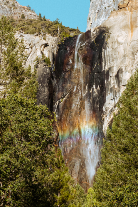
A paved path leads to the base of Bridalveil Falls. My tip: Stop here before heading to Tunnel View for sunset. From the parking lot, the light hit the falls perfectly and created a rainbow.
I think people thought I was crazy for taking photos from the parking lot, but hey, you couldn’t see the rainbow when standing right under the falls at the end of the path. It wasn’t busy at this time of day, although when we drove by another time in the morning, the parking lot was packed.
Emma’s Verdict
I really got a kick out of watching the waterfall blow in the breeze. It was a pretty light flow when we were there, but beautiful nonetheless. I could have sat and watched it for an hour.
10. Glacier Point Walk
Best For: Half Dome views
Trail Map: Glacier Point
Trail Stats
- Distance: 0.6 mi
- Elevation Gain: 50 ft
- Difficulty: Easy
- Area: Glacier Point Road
My Trail Experience
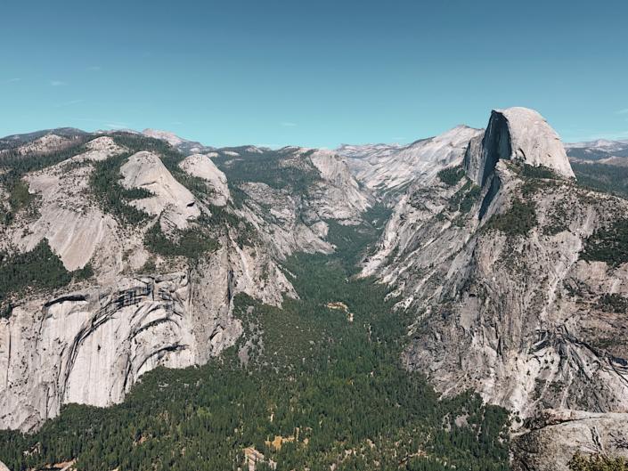
This is arguably Yosemite’s most iconic view. Not only can you get incredible views of Half Dome, but you can also see Vernal and Nevada Falls.
If you’re going to hike up to Nevada Falls, come to Glacier Point afterward. I thought it was so special to see the falls from far away after already having been there up close.
Bonus: There’s a small convenience store at Glacier Point. Get yourself a little ice cream treat and sit outside to eat it.
Emma’s Verdict
I actually thought the best perspective was from the Geology Hut. Make sure to walk over there while you’re exploring the area. Glacier Point can get very busy at sunset, so if you plan to come then, arrive early to secure a parking spot.
Tips for Hiking in Yosemite
Start hiking early. Especially for popular Valley hikes and trailheads with limited parking. Always check trail conditions before you go.
Expect to do some driving. If you’re planning multiple hikes in a day or moving between campsites, you’ll spend more time driving than you might expect. The park is big!
High-country hikes can be more challenging than you think. Sun exposure and thinner air can be sneaky, especially on longer hikes.
Bring more water than you think you need and pack electrolytes. For several of these hikes, my husband and I carried light running vests and filtered water along the way. That way, we didn’t need to carry four liters of water at one time.
Expect crowds to vary dramatically. We saw practically no one on some of these hikes and then hundreds of people on others. Just know that hikes in Yosemite Valley will generally be the most crowded.
➡️ Before or after your visit to Yosemite, consider stopping at Great Basin National Park in Nevada. It’s an underrated National Park you won’t regret visiting.
📌 Pin this image on Pinterest to save this post for reference.
Hikes in Yosemite FAQs
What is the best hike in Yosemite Valley?
I’d choose Vernal and Nevada Falls. The hike is challenging, but you get to see two major waterfalls up close and experience the unique perspective of standing at the top of both falls.
What is the best easy hike in Yosemite?
May Lake is my pick for an easy hike with beautiful scenery. The trail is only 2.4 miles round trip with 490 feet of elevation gain, and the lake makes a worthwhile destination without requiring a full day of hiking.
What is the best hike in Yosemite for views?
North Dome and Indian Rock is my pick for panoramic views. North Dome gets you remarkably close to Half Dome, while Indian Rock gives you a unique view through the natural arch.
Are Yosemite hikes crowded?
Crowds vary dramatically depending on the trail and location. The hikes in Yosemite Valley tend to be the busiest, while we found much quieter trails in the high country and other areas of the park. For example, we had North Dome almost entirely to ourselves when we visited.
How difficult are the hikes in Yosemite?
Yosemite has everything from short, paved walks to strenuous full-day hikes. Don’t judge a hike only by its mileage. Elevation, sun exposure, terrain, and higher elevation in the high country can all make a trail feel more difficult than expected.
What are the best hikes in Yosemite?
The best hikes depend on what you’re looking for, but my top picks from the trails I personally hiked are Cathedral Lakes, Vernal and Nevada Falls, and North Dome. They offer very different experiences, from alpine lakes and mountain scenery to waterfalls and panoramic views of Yosemite Valley.